

In the golden age of Zillow, the first showing doesn't happen at the front door; it happens on a smartphone screen. For sellers in New Hanover, Pender, and Brunswick counties, this digital curb appeal is everything.
But here is the hard truth: If you are selling coastal property with ground-level photos only, you are leaving money on the table.
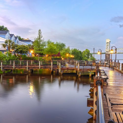
In a standard suburban neighborhood, a drone shot is a "nice to have." In our region—where value is dictated by proximity to water, marsh views, and flood zones—it is a "must-have."
Here is why aerial photography is non-negotiable for your listing in 2026, and why hiring a professional pilot is about more than just pretty pictures.
1. Context is Currency
In Southeastern North Carolina, "Location, Location, Location" actually means "Water, Water, Water."
The Problem: From the driveway of a home in Hampstead, you might see a garage door and a pine tree.
The Drone Solution: Go up 200 feet, and suddenly you see that the property backs up to a navigable creek that leads directly to the Intracoastal Waterway (ICW).
The Value: You aren't just selling a house; you are selling the access. Showing the proximity to the boat ramp, the cut-through to the ocean, or the short walk to the beach access is what justifies your asking price.
2. The "Flood Zone" Reassurance
Flooding is the number one objection for buyers in our market.
The Psychology: A ground-level photo of a home in Bolivia or Castle Hayne can't show topography. A buyer might assume, "It’s near the river; it probably floods."
The Drone Solution: An aerial shot can visually demonstrate the "High Ground." Showing your home perched on a ridge, clearly elevated above the surrounding marsh or creek, offers subconscious reassurance that a FEMA flood map can't match.
3. The "No Fly Zone" Minefield (Why DIY is Dangerous)
We often hear sellers say, "My nephew has a drone; he can take the pictures." This is a legal liability waiting to happen. Our region is one of the most complex airspaces in the country.
Wilmington International Airport (ILM): If your home is within 5 miles of ILM (which covers large swaths of Wilmington), it is a federal crime to fly a drone without LAANC authorization from the FAA.
Camp Lejeune & Military Routes: In Onslow and Pender counties, military training routes (MTRs) and restricted airspace (like R-5306A) create invisible fences. Flying here without clearance isn't just a fine; it’s a national security issue.
The NC State Park Ban: Did you know it is illegal to launch or land a drone from a North Carolina State Park (like Carolina Beach State Park or Fort Fisher) without a special permit?
4. Part 107 is the Law
The FAA is clear: if a drone flight is in furtherance of a business (i.e., selling a house), the pilot must hold a Part 107 Remote Pilot Certificate.
The Risk: If you use unlicensed footage in your listing, the FAA can fine the pilot and the hiring agent/homeowner up to $11,000 per violation.
The Standard: At Aspyre, we only work with licensed, insured pilots who understand airspace authorizations. We protect your liability as fiercely as we protect your equity.
We Sell the Whole Story
A house in Southport is more than four walls; it’s the walk to the marina, the view of the lighthouse, and the oak canopy overhead. You cannot capture that from the sidewalk.
At Aspyre Realty Group, we believe in using every tool available to tell your home’s story. We understand the unique geography of our coast and the complex airspace above it. If you are ready to list your home with a marketing strategy that looks at the big picture (literally), let’s connect.
Check out this article next