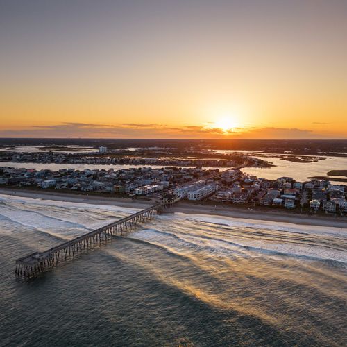

For anyone flying into ILM, the view from the window reveals a peculiar pattern etched into the landscape of Bladen, Pender, and New Hanover counties. Thousands of perfectly oval depressions, all aligned in the exact same northwest-southeast direction, dot the coastal plain. These are the Carolina Bays, and while they are a source of fascination for geologists, they pose a very specific set of questions for real estate buyers and investors.
Are they ancient impact craters from a meteor shower, or just the work of prehistoric winds? More importantly, what happens if you try to build a house on one?
The "Cosmic" Myth vs. The Wetland Reality
To locals, these features are often just known as "bays" or "pocosins" (an Algonquin term for "swamp on a hill").
The Myth: For decades, the prevailing theory was that a massive meteor or comet broke apart over North America roughly 12,000 years ago, showering the Carolinas with icy fragments that gouged out these craters. It’s a compelling story that adds a touch of sci-fi to our region.
The Reality: Modern science leans heavily toward the lacustrine-eolian theory. This suggests that during the last Ice Age, strong prevailing winds shaped shallow lakes into these uniform ovals over thousands of years. While less dramatic than a meteor strike, the result is the same: thousands of isolated, peat-filled basins that hold water like a sponge.
The Investor’s Warning: Peat and Permits
For a buyer in Hampstead, Castle Hayne, or the outskirts of Wilmington, the Carolina Bays are not just trivia; they are a geological factor that affects land value and buildability.
1. The Foundation Hazard: Peat Soils
The bottoms of these bays are filled with peat—organic material that has accumulated for millennia. Peat is highly acidic and unstable.
Shrink/Swell: When peat dries out (during a drought), it shrinks significantly. When it gets wet, it swells. If a home’s foundation is built on a filled-in bay without proper soil remediation, this movement can crack slabs and shift footings.
The "Fire" Risk: Believe it or not, dried peat is flammable. In extreme drought conditions, "ground fires" can burn underground in these areas, as seen in historical fires in regional pocosins like the Green Swamp or Holly Shelter.
2. The Regulatory Shift (Sackett v. EPA)
Historically, many Carolina Bays were protected as federally regulated wetlands. However, following the recent Sackett v. EPA Supreme Court ruling, federal protection for "isolated wetlands" (those without a continuous surface connection to navigable waters) has been rolled back.
The Trap: This means land that was previously "unbuildable" might now legally be developed. An investor might see a cheap, large tract of land in Pender County and think they’ve found a goldmine. Without realizing they are buying a "dry" Carolina Bay, they could face astronomical costs for fill dirt and soil stabilization to make it viable.
Your Next Step
The geology of the New Hanover and Pender region is beautiful, but it requires respect. Whether you are looking for a hunting tract in Bladen County or a new construction home in a developing area of Rocky Point, you need to know what lies beneath the grass.
A truly strategic real estate purchase involves looking at soil maps as closely as floor plans. We are experts in listening and communicating people's wants into homes that work for them—and that means ensuring your investment is built on solid ground, not a prehistoric geological anomaly. Let Aspyre Realty Group help you navigate the unique terrain of our coastal market.
Check out this article next